Mount Sneffels, Colorado 14,150 ft.
Mt. Sneffels' North Face
 Mt. Sneffels, Colorado is a spectacular peak in the heart of the San Juan Range of the south central Colorado Rockies. It is one of the 54 "Colorado 14ers" and ranks 28th in the state. It looms over Ouray, Colorado, Engineer Pass, and
 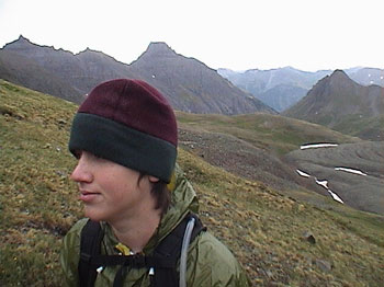 everything else around it as it guards the Mt. Sneffels Wilderness. This mountain and the area around it is very popular in the summer with tourists and 4WD enthusiasts. Yankee Boy Basin on the south side of the mountain is the starting point for the standard Lavender Col (or Scree Col) route. We have always wanted to climb Mt. Sneffels because it offers more of a challenge than the typical walk-up 14ers and is one of those peaks which are a "must do". Sneffels offers several routes to the summit, the easiest being a
 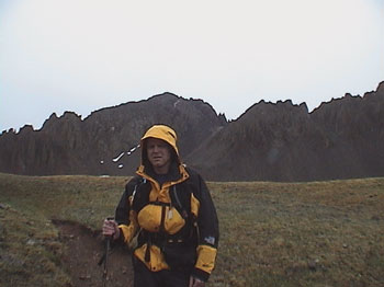 Class 2 route with minor scrambling near the summit. There is also a class three ridge via the southwest ridge and several north face technical routes. We (Alan, Jackie, and son, Andrew) drove all day and camped at Ridgeway State Park north
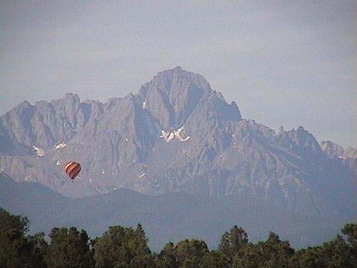
of Ouray, Colorado. Colorado typically has very nice state parks and Ridgeway was no
Class 2 route with minor scrambling near the summit. There is also a class three ridge via the southwest ridge and several north face technical routes. We (Alan, Jackie, and son, Andrew) drove all day and camped at Ridgeway State Park north
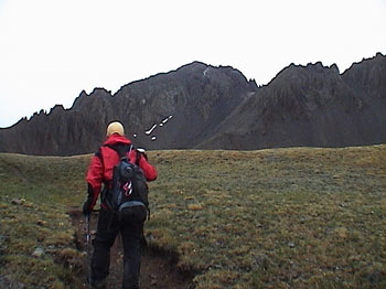
of Ouray, Colorado. Colorado typically has very nice state parks and Ridgeway was no 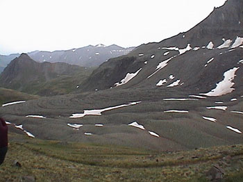 exception. There are wonderful views of the north face of Sneffels from Ridgeway. We got up at 5:00 a.m. for breakfast and a 45 minute drive to the trailhead. The drive up Canyon Creek road is an exhilarating experience with steep drop-offs and overhanging cliffs. As we arrived at the trailhead it began to sprinkle and the sky was overcast. Actually, overcast and a little rain is better than the typical thunderstorms in the San Juans, so this was good climbing weather. A gradual climb up into Yankee Boy basin is soon rewarded
 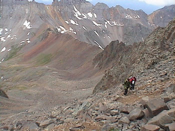 by towering peaks to either side and an ultimate view of Mt. Sneffels. A couple of young women hiked quickly passed us as we rested. It began to rain hard so we put on rain gear and pressed harder. As we arrived into Yankee Boy Basin proper, I no longer saw the young women and instead got my first good view of the scree slope which we would soon begin
climbing. The scree
by towering peaks to either side and an ultimate view of Mt. Sneffels. A couple of young women hiked quickly passed us as we rested. It began to rain hard so we put on rain gear and pressed harder. As we arrived into Yankee Boy Basin proper, I no longer saw the young women and instead got my first good view of the scree slope which we would soon begin
climbing. The scree  slope up to Lavender Col (or Scree Col) is a 600 ft nightmare of loose gravel and rock. Take one step up....slide two steps down. About halfway up, the women caught up with us and directed us to climb more to the left where the rock was more solid. Upon arrival at the col (13,500 ft), it began to snow. We began the scramble up the long gully to the summit while it snowed harder. A man and his nephew hiked along with us as we reached the notch to the left. The notch is a break in the gully which allows access to the summit. The notch requires a little hands-on climbing with a little
 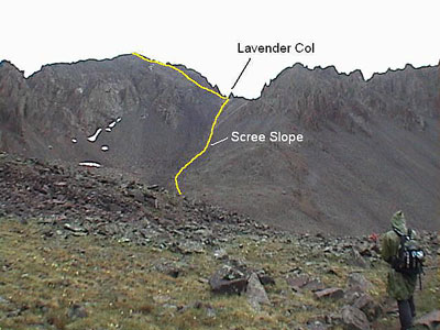 exposure to the left. After the notch, a cairn comes into view up and to the right. Stay right after the notch to avoid extreme exposure to the left. Shortly after the cairn, the summit appears. We arrived at the summit with two other parties in the blinding snow. A few pictures and we began our descent. The hike back to the trailhead was somewhat disappointing. A lot of 4WD vehicles showed up and kind of spoiled the scenery. But overall, we enjoyed our climb in the rain/snow. As always....thank you Mt. Sneffels for a great climb and overall experience.
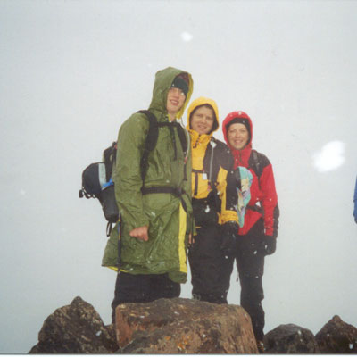
On the summit!
